October 27, 2024
Intro
I am in the midst of a project to scan all of my father's (Michael's) 35mm slides (current estimate: some 4500 of them).
Click on thumbnails to see larger versions.
Street scenes in Cape Town, 1962
In September 1962, my father went to South Africa for a cosmic rays balloon experiment based in the small town of Calvinia. My mother and sister (I wasn't born yet!) came to South Africa but stayed in Cape Town. Upon his return after the balloon campaign, they stayed on together for a few weeks, into October.
Some of his photos show street scenes around Cape Town, a fascinating view of the people from more than 60 years ago.
Location mysteries
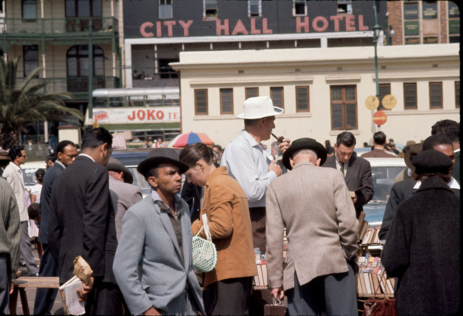
For three photos in particular, I wanted to know where they were shot. These was one that he marked on the cardboard slide mount "No. 1 Union Street — my birthplace!"The other two images show an open-air used book market with many people milling around. The cross-section of society here is fascinating in and of itself. Clearly taken somewhere in Cape Town, but where?
Used book fair photos
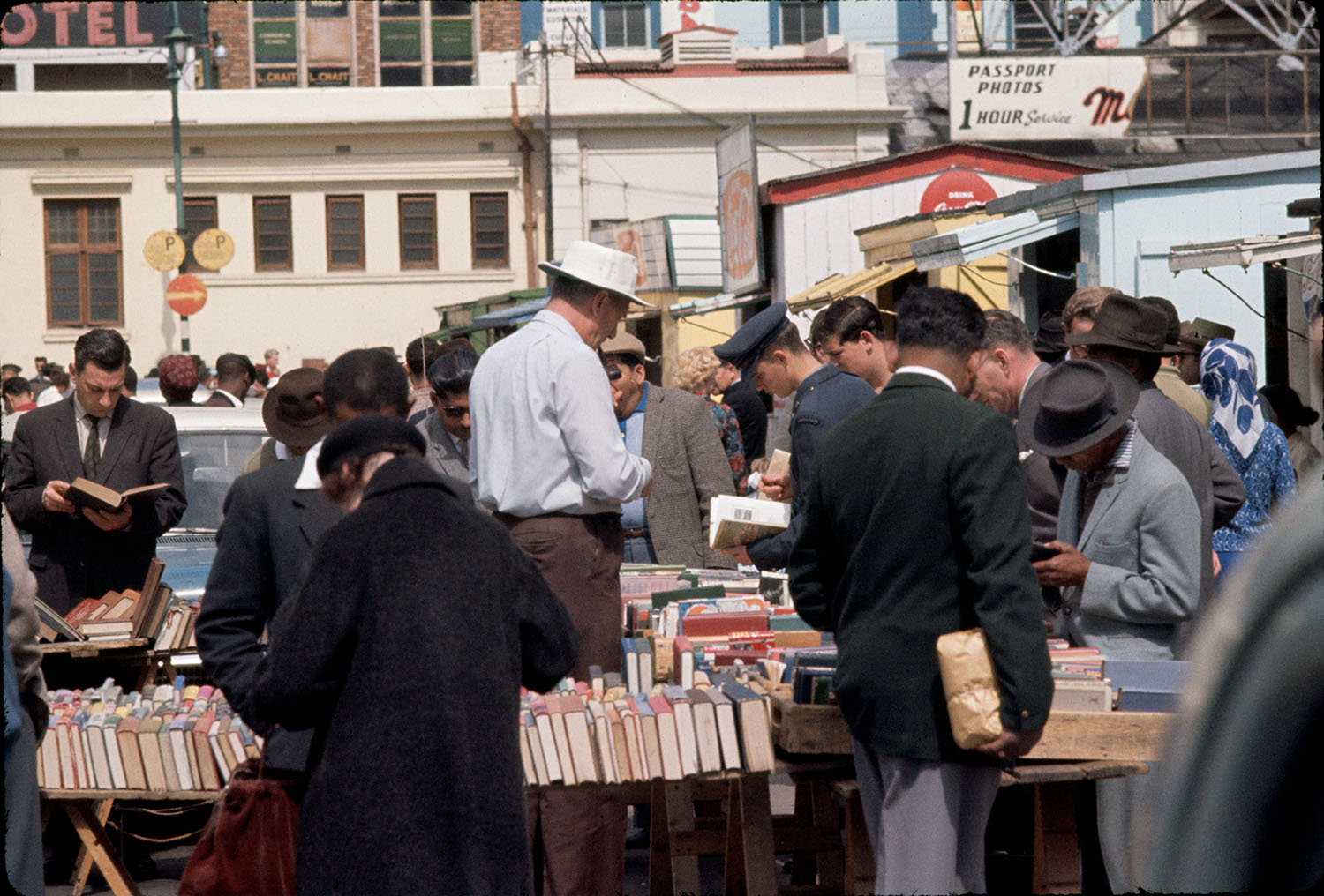
These slides have no frame numbers marked on them, so one cannot glean anything from numerical ordering, as there is none (unless I tore open the slide mounts to see the edgeprint on the original film).
The first image (with a tall man in a white hat and a soldier in the center) gives almost no indication of where it was taken. The other image, however, shows "City Hall Hotel" in large letters on a building in the background.
Sleuthing
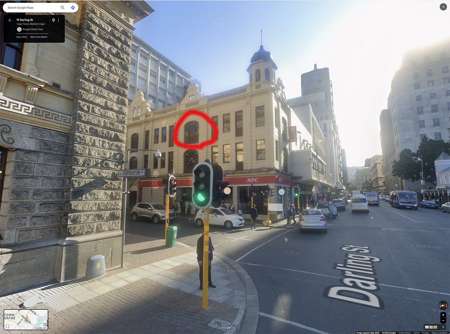
So, of course, the first thing I did was to Google "City Hall Hotel Cape Town". This was not helpful, as it simply brought up results for numerous aggregator travel web sites for hotels near City Hall! So, then I searched for City Hall itself, to see where it was. (Yes, I have been to Cape Town 4 times (twice as a young child), most recently 1997, but I don't have a block-by-block mental map of the city.)
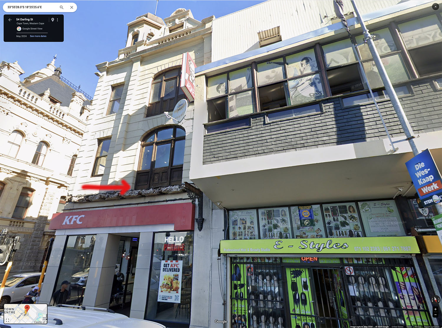
Going back to the (second) original photo, I noticed the building to the left of the City Hall Hotel, which had an unusual door/window construction with triple panes of glass and a curved top, with quarter circles of glass in the upper left and upper right of each such grouping.
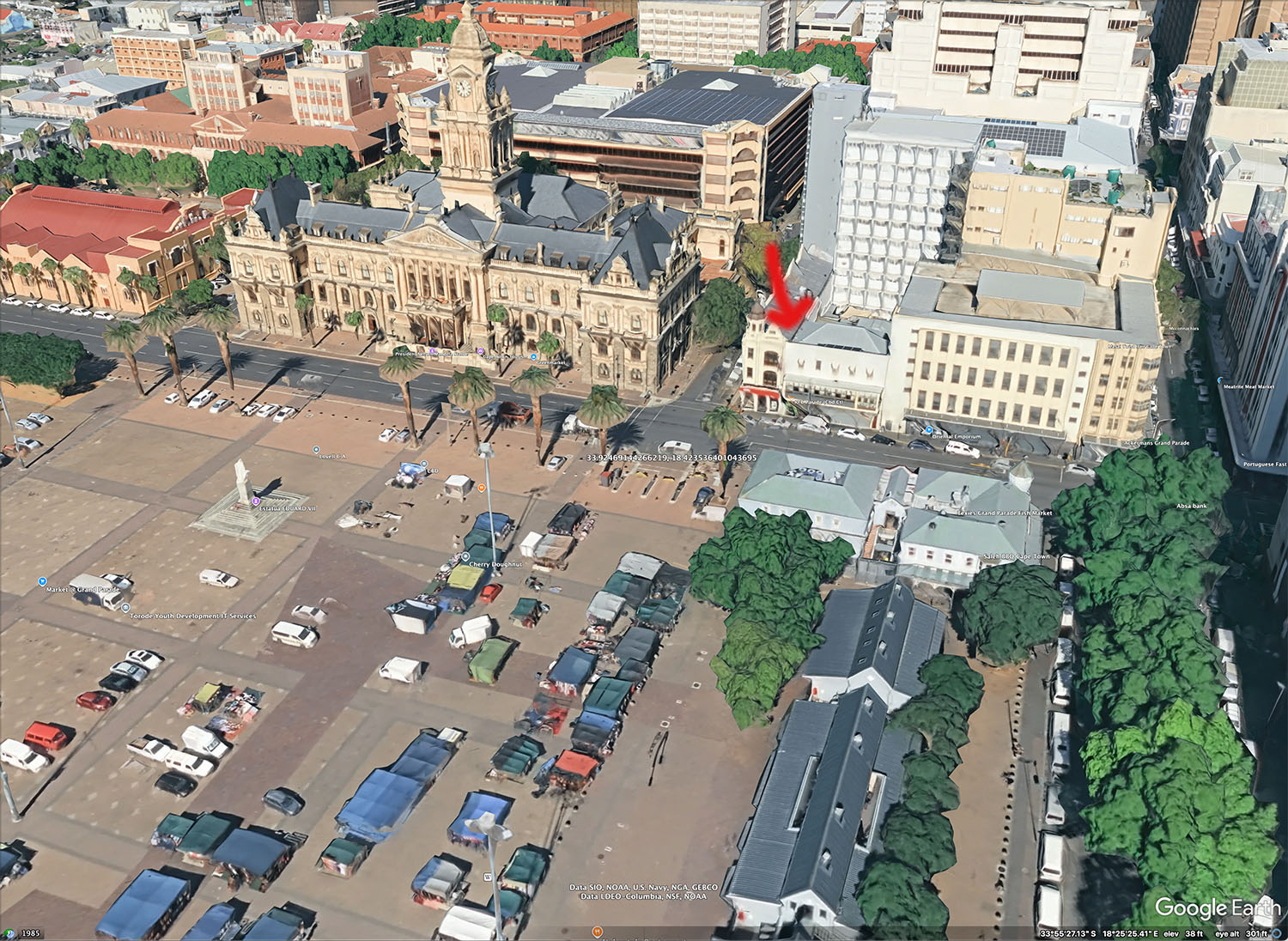
Using Google Maps (with Google Street View) as well as Google Earth Pro, I "went" to City Hall, and then looked around. City Hall is on Darling Street, and immediately across a side street I found the building with the interesting windows! However, it was on the "wrong" corner compared to the photo, so I kept going down Darling Street, and now this building was in the same orientation as the 1962 photo, with another building to its right. I did not recognize it as the hotel at first, since it had been repainted and the open second floor balcony had been enclosed. Also, the wrought iron balconies on the first building had been removed (rather roughly, judging by the modern photo). The old hotel building still shows five windows across the front, so it is clearly the same structure, upon closer examination.
Looking around from the Google mapping resources (Maps and Earth), I could see a large plaza which to this day hosts an open-air market. The off-white building in the middle-ground of the 1962 photos appears to no longer stand, as a different structure is in the same place. So it might not be possible to reproduce the exact same sightlines today (if a building or trees are now in the way). Still, we know within 100 feet or so where these images were taken!
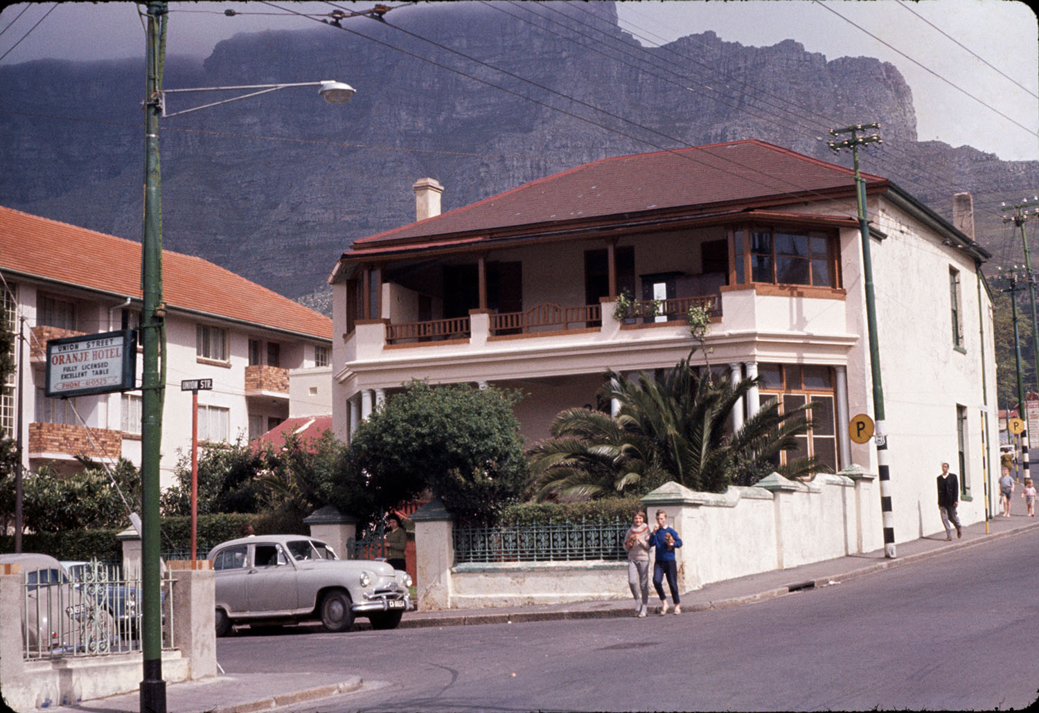
Union Street photo
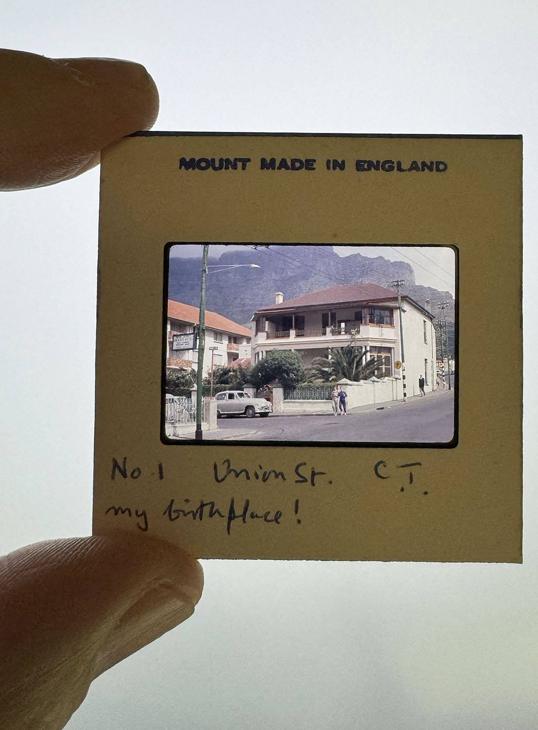
I had not seen this image before, nor heard my dad speak of this building. My mom said it may have been a maternity/birthing center of some sort. And apparently it was the same building, as my dad's delighted caption indicates! (He took this photo 34 years after he was born (November 1928 to photo date of October 1962).
Sleuthing
Searching in 2024, I found that there was more than one Union Street in Cape Town. However, the majestic view of Table Mountain behind the buildings I figured would be helpful, as well as knowing that the building stood on a street corner of Union Street and something else (i.e., not mid-block). So, I found a Union Street in the neighborhood of "Gardens", which went from Hof St to Kloof St. The Hof St intersection with Union Street did not look promising, in terms of the buildings there. Yes, I found a house whose large sign said #3 Union Street, but where #1 would have been did not look at all like the one in the 1962 photo. After hunting a bit, I let it rest for a couple of weeks.
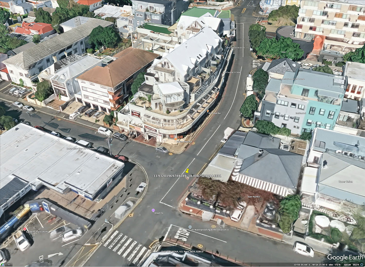
Then I came back to it and looked at the other end of the street. A completely different building now stood on the corner with Kloof St., such that I was not even sure that I was in the right place. Other indicators suggested I was in the right place, from the mountains and the street-that-wasn't-Union-St curving uphill from the photographer. But the newer building was four stories tall, not two-plus-a-roof, so I could not match the vantage point of the street and the mountains to be certain.
Then I noticed the building next door. (While zooming in 400% to get rid of dust marks on the slides, I get to know details all over a given image.) In the 1962 photo, the building to the left of the house he photographed and identified is white and has distinctive brown brick balconies, along with rectangular 4-part windows. In Google Street View, clicking the arrow to go "down the street" from this intersecton, I got a closer look at the building next door. It looks the same as 1962! It's called The Santorini and is number 29 Union Street.

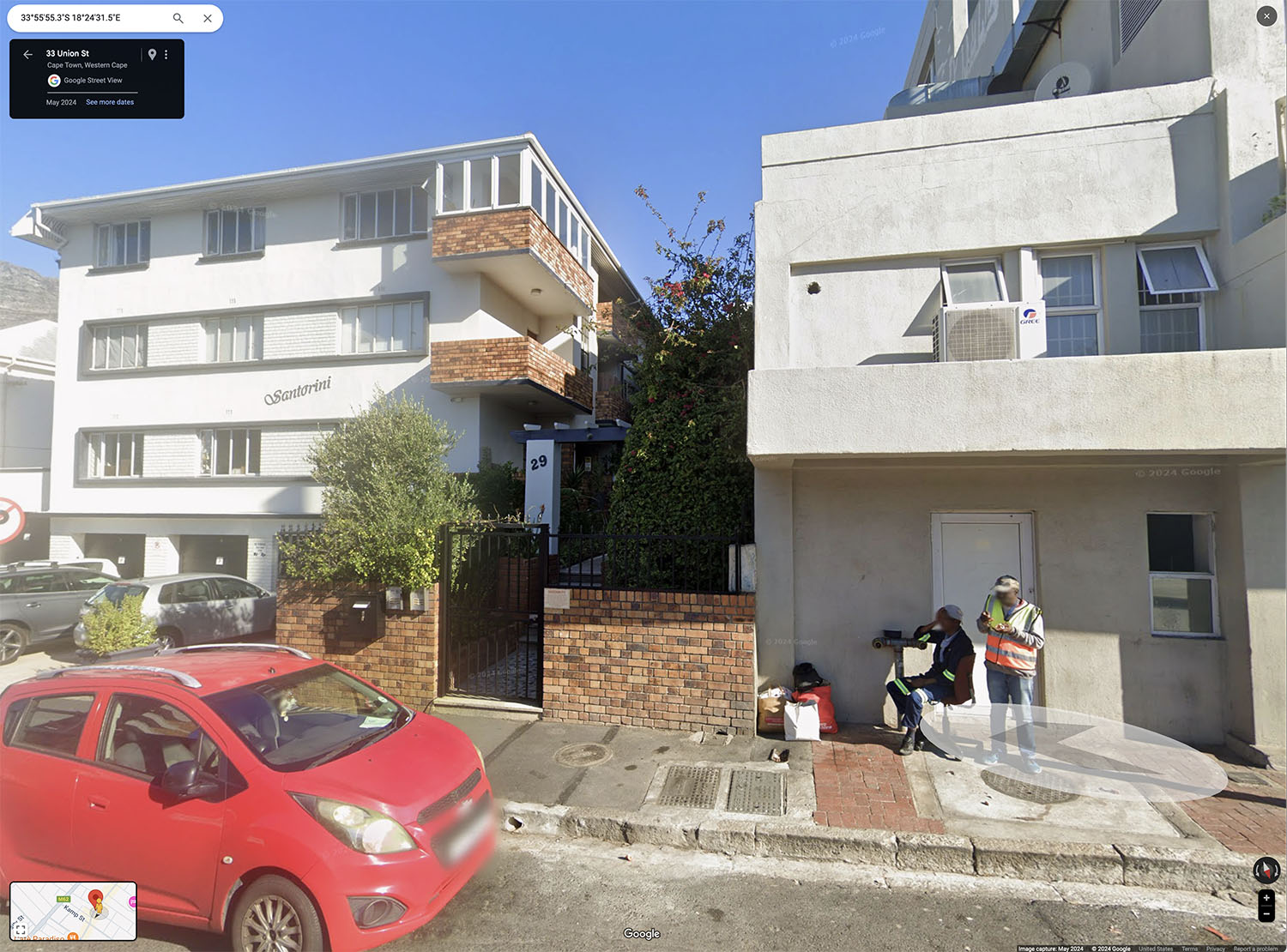
So, this means that although he had the street number wrong (unless it got renumbered in the intervening time (not impossible)), but I was nonetheless able to find the same intersection!
[Aside: On one visit to Cape Town, I was told that street numbers
continued consecutively independently on each side of any given street. So, if one side had multiple wide buildings and the
other side did not, one could get into a situation where the numbers on opposite sides of the street were far off
from one another. For example, if one side had houses numbered 2 through 24, but the facing side had
several large apartment buildings, numbered 1,3,5,7, then #7 and #24 would be across from one another.
So, either this was a simple mistake on my dad's part, or maybe the numbering got changed at some point?]
Mysteries solved!
Please note these links below will open in new tabs.
The Union Street photo of "MIchael's birthplace" was taken at the intersection of Kloof Street with Union Street.
The coordinates are:
-33.93201969744189, 18.40875290944331, plus the
Google Maps link
, the
Google Street View link
and the
Google Earth link
The used book market photos were taken at a plaza ("The Grand Parade"?) across Darling Street from City Hall.
The coordinates are:
-33.92469144266219, 18.423536401043695, plus the
Google Maps link, the
Google Street View link, and the
Google Earth link
Conclusion
One gets spoiled by modern smartphones which geotag every photo with the location where it was taken (as well as the time and
date, of course). But figuring out where film photos were taken can be a much bigger challenge, but is oftentimes still possible,
thanks to modern Internet tools!